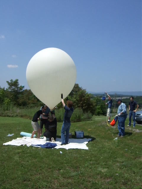
HacDC Spaceblimp 5
From HacDC Wiki
Spaceblimp-5 Launched: July 9, 2011
Summary
This time we were going for altitude. By using a larger balloon, hopefully it will burst at a higher altitude, 120k feet predicted. (117k actual. Within 3%. Not too shabby!!)
The launch site was: Strasburg VA, in a open area near the town on Rt 11, near the I-81.
Lat: 38.9968 N
Lon: 78.3508W
Or follow along at home! There are two radios on board the blimp that transmit out the GPS data:
- The primary radio is tied to the GPS and transmits out to a network of amateur radio enthusiasts who then pass the location information on to get mapped here: APRS.fi. We also are running some custom software that passes this data on to a Twitter account (once per minute!) which you can follow on your phone: DC Spaceblimp Primary Twitter Feed. (Click the link in the Twitter to pull up a map!)
- The secondary radio is actually a GSM cell phone module, and will broadcast its data when in range of a cell tower. It will be broadcasting both GPS data for tracking, and a lot of the sensor data for science. You can follow that Twitter feed through Society Of Robots Twitter Feed.
Payload
The payload contains a couple cameras:
- a video camera (Canon Zi6)
- a still camera (Canon Powershot A-480) running custom firmware to get better exposures from space
and a lot of instrumentation:
- a geiger counter
- 9 degree-of-freedom IMU (Inertial Measurement Unit on Wikipedia)
- high-speed (50 sample/sec) accelerometer
- internal and external temperature sensors
- humidity sensor
- air pressure sensor
- IR and visible light sensors
- a solar panel, hooked up to measure the voltage
Data
Accelerometer
For now, here is the raw accelerometer data: [Media: spaceblimp5_accelerometer.csv.gz]
Analysis to come in the next few days....
Flight Tracker
Launch Plans
| Planned launch date: | Saturday, July 9, 2011 |
|---|---|
| Launch time: | 10:00 AM, Launch should take less than an hour. |
| Launch Location: |
Strasburg, VA |
| Coordination/Talk-in: | 146.685 MHz simplex (this might change, please monitor Twitter (@HacDCSpaceblimp) and mailing list for updates. |
| Planned Altitude: | 120,000 Feet |
| Planned Ascent Rate: | 1,000 feet/minute |
| Planned Descent Rate: | 1,000 feet/minute |
| Primary Beacon: | Son-of-WhereAVR with ublox GPS. Yaesu VX-1 handi-talkie with 1 W Transmitter, call sign W3HAC-11 (map), Frequency 144.390 MHz |
| Secondary Beacon: | GSM mobile phone modue, uBlox GPS |
| Payload: | 9 DOF IMU, Geiger counter, temperature, pressure, humidity, and light sensors |
| [email protected] |
| Subscribe to the Spaceblimp email list |


