HacDC Spaceblimp 3: Difference between revisions
From HacDC Wiki
m (→Launch Details) |
No edit summary |
||
| (17 intermediate revisions by 6 users not shown) | |||
| Line 1: | Line 1: | ||
{{TOCright}} | |||
; If you want to get involved or learn more or contribute to the program... | ; If you want to get involved or learn more or contribute to the program... | ||
: [http://hacdc.org/mailman/listinfo/spaceblimp Subscribe to the Spaceblimp email list] | : [http://hacdc.org/mailman/listinfo/spaceblimp Subscribe to the Spaceblimp email list] | ||
== Photos == | |||
[[Image: SB3_teaser_image.jpg | thumb]] | |||
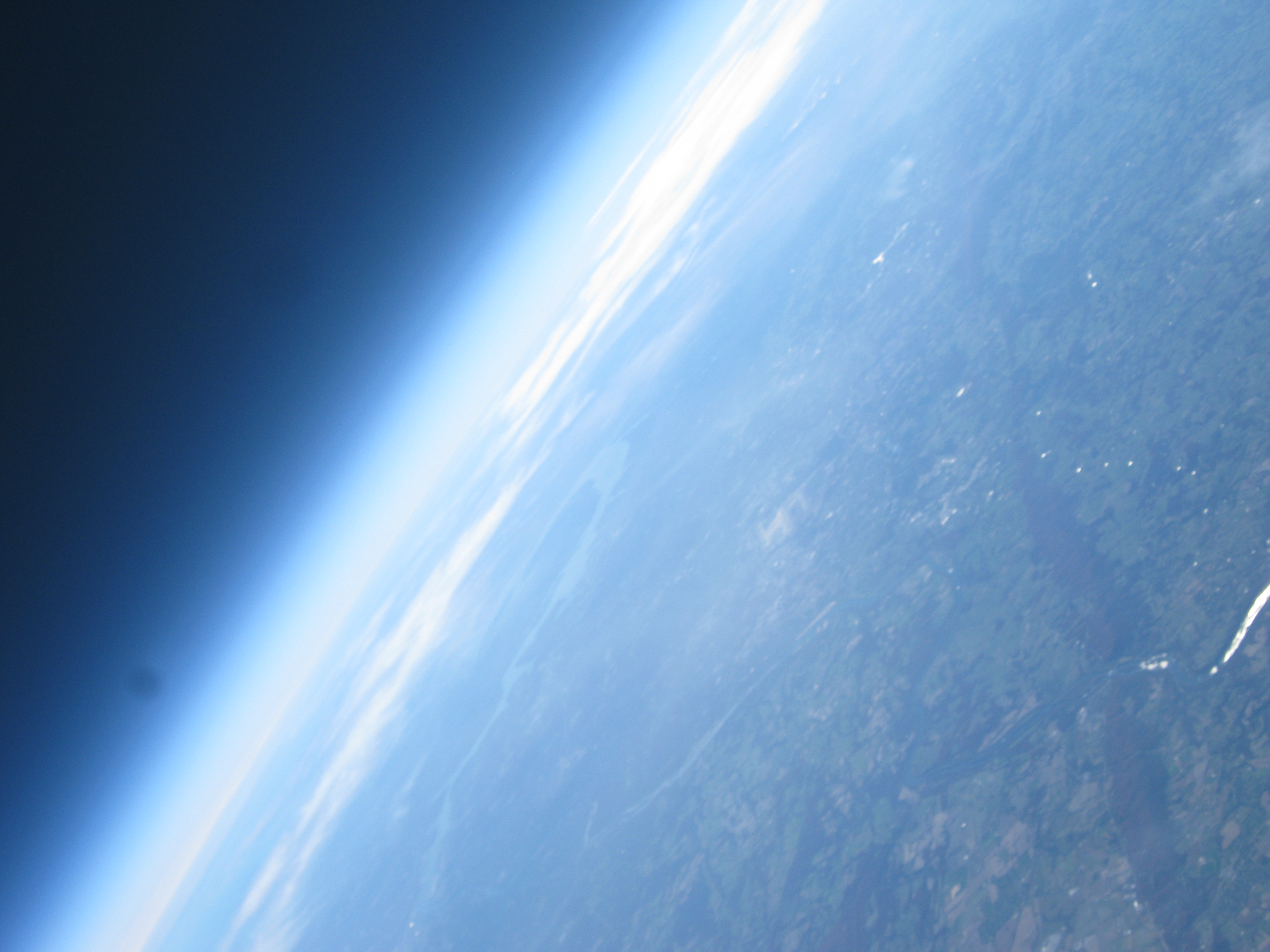
Spaceblimp 3 went up with two still cameras and a non-functioning video camera. There are tons of neat pics from both. These links get you into the series right before liftoff. | |||
* [http://gallery.jbwa.net/SpaceBlimp/SB3/Camera1/?g2_page=11 Camera one: liftoff] | |||
* [http://gallery.jbwa.net/SpaceBlimp/SB3/Camera2/?g2_page=6 Camera two: liftoff] | |||
These are about as far out as we got before the balloon popped: | |||
* [http://gallery.jbwa.net/SpaceBlimp/SB3/Camera1/?g2_page=30 Camera one: space!] | |||
* [http://gallery.jbwa.net/SpaceBlimp/SB3/Camera2/?g2_page=38 Camera two: space!] | |||
And then, recovery: | |||
* [http://gallery.jbwa.net/SpaceBlimp/SB3/Camera2/?g2_page=63 Camera two: land again] | |||
== The Dataz! (Telemetry) == | |||
* Accelerometer data. Unfortunately, it looks like there was a bug in the code and the second half of the data overwrote the first. Anyway, here it is. It's 100 samples per second, start time unknown, but it looks like it captures the pop, some freefall, and the landing. [[Media:AccelerometerDumpfile 2010-11-13 18-24-41.csv.gz]] | |||
== Launch Details == | == Launch Details == | ||
| Line 15: | Line 38: | ||
|- | |- | ||
!align="right" valign="top"| Launch Location: | !align="right" valign="top"| Launch Location: | ||
| | | | ||
:Time: arrive at 9:00 A.M. (please be on time!) | |||
: Where: Clear Spring Public Library | |||
: Address: 12624 Broadfording Road, Clear Spring, MD 21722-1361 | |||
: Lat/Long: 39.65664, -77.93637 | |||
: North on I-270 | |||
: Exit 32 to merge onto I-70W | |||
: Exit 18 to merge onto MD-68W | |||
: Left at US-40W/National Pike | |||
: 3rd right onto Broadfording RD | |||
: Library is on left | |||
|- | |- | ||
!align="right"| Coordination/Talk-in: | !align="right"| Coordination/Talk-in: | ||
| | | 146.415 MHz simplex | ||
|- | |- | ||
!align="right"| Planned Altitude: | !align="right"| Planned Altitude: | ||
| Line 56: | Line 90: | ||
{{Template:Spaceblimp}} | {{Template:Spaceblimp}} | ||
Latest revision as of 07:55, 3 April 2012
- If you want to get involved or learn more or contribute to the program...
- Subscribe to the Spaceblimp email list
Photos
Spaceblimp 3 went up with two still cameras and a non-functioning video camera. There are tons of neat pics from both. These links get you into the series right before liftoff.
These are about as far out as we got before the balloon popped:
And then, recovery:
The Dataz! (Telemetry)
- Accelerometer data. Unfortunately, it looks like there was a bug in the code and the second half of the data overwrote the first. Anyway, here it is. It's 100 samples per second, start time unknown, but it looks like it captures the pop, some freefall, and the landing. Media:AccelerometerDumpfile 2010-11-13 18-24-41.csv.gz
Launch Details
PLEASE NOTE - NEW DATE!
| Logistics planning and radio check meet: | Monday Nov 8, 7:00 PM at HacDC |
|---|---|
| Planned launch date: | Saturday, November 13, 2010 (Rain date November 14). |
| Launch time: | 9:00 AM, Launch should take less than an hour. |
| Launch Location: |
|
| Coordination/Talk-in: | 146.415 MHz simplex |
| Planned Altitude: | 92,000 feet |
| Planned Ascent Rate: | 1,000 ft/min |
| Primary Beacon: | Tiny Track 4 with 0.5 W transmitter on 144.390 MHz, call sign W3HAC-11 (map). $3 GPS module |
| Secondary Beacon: | Son-of-WhereAVR with ublox GPS. Yaesu VX-1 handi-talkie with 1 W Transmitter, call sign W3HAC-12 (map), Frequency 445.15MHz |
| Other sensors: | Recording accelerometer, air pressure based altimeter, cosmic ray counter |
Help Wanted:
If you spot something you can handle or wish to learn about, we'd love to have your help. (Seriously, meeting more people like you is major goal of HacDC.)
- Blog about upcoming flight
- Document HacDC Spaceblimp 1 on wiki
- Build primary & secondary beacon antenna
- Altimeter selection & purchase
- Purchase 32 GB SDHC memory card for video
- Build battery pack for video
- Make weatherproof labels/tags for capsule recovery (laminate, 3d print, laser cut, etc.)
- Work on CHDK scripts for still cameras
- Build capsule/rigging/chute
- Vacuum test Geiger counter
- New software for additional sensors (add small μC?)
Contact Info:
If you would like to help, contact [email protected].
| [email protected] |
| Subscribe to the Spaceblimp email list |

